Finally the oldest existing map yet is going to be displayed!
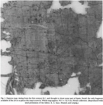
The so called "oldest map" or else described as the "oldest map of Spain", which is dated to the Ist century BC will be displayed publicly during the Winter Olympics at Turin (Italy). Discovered in 1998 the map is in papyrus and believed to be linked to Roman source describing Spain. A short article about it was published by Professor Kramer in Imago Mundi (2001: pp. 115-120). The photograph displayed here is taken from Kramer's article. This is fresh news!!! it's being reported through the mailing list of map-history and it seems to be serious stuff; here is the link to the whole news report:
"Turin to reveal world's oldest map: Papyrus of Artemidorus on show on eve of Winter Olympics
(ANSA)-Rome, January 5 - Turin is to uncover the world's oldest surviving map as part of the rich programme of cultural events accompanying February's Winter Olympics .The 1st-century-BC Papyrus of Artemidorus, which contains the map, will go on display for the first time ever at the city's Palazzo Bricherasio from February 8 to May 7. The parchment, which is over 2.5m long and 32.5cm wide, was found by chance at the end of the 20th century. Its importance has been compared to that of the Dead Sea Scrolls. It features the account of a trip to Spain of a previously obscure Greek geographer, Artemidorus of Ephesus, and the map, which is unfinished and impossible to relate to any particular region ."
posted by Tarek طارق @ 1:30 PM
0 comments
![]()


0 Comments:
Post a Comment
<< Home